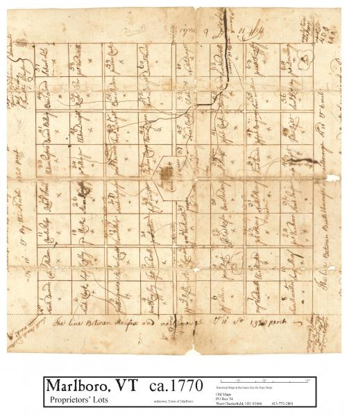
This is the first map drawn of the Town of Marlboro, showing the grid placed over the wilderness in 64 "rights" of 360 acres each, sold to people sight unseen, as land speculation.